“summer turns me upside down
summer summer summer
it’s like a merry go round”
-the cars
Gales, Invests, Tropical Depressions, Tropical Storms, Hurricanes – beware!
Currently the Atlantic Season lasts from June 1 to November 30, the dates have shifted through out time.
Tracking and understanding hurricanes is a relatively new science considering our technology advancements, not to mention their unpredictability.
Articles here and here can give you a more professional recap of 2016’s events.
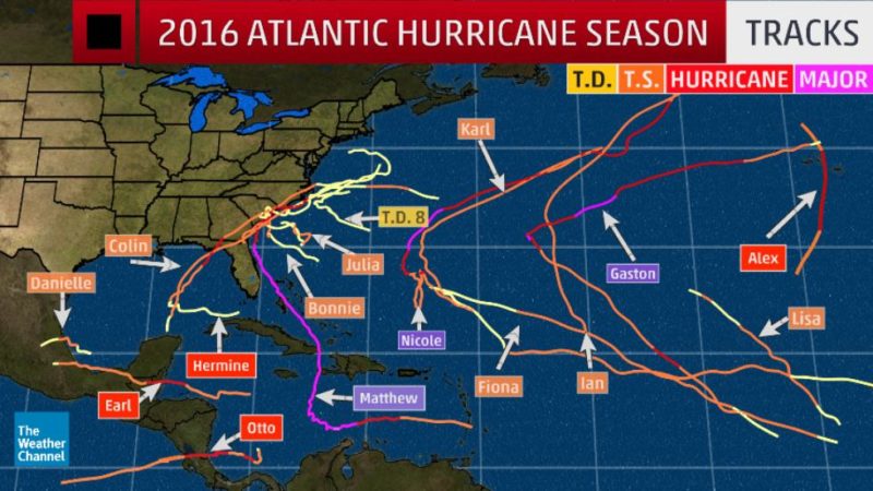
courtesy NHC
With the sailboat sitting out of the water in a fairly wind protected boat yard. Claire and I were living and working on the outer coast of North Carolina. Vulnerable to just about any puff of wind, we learn to deal with extreme weather here.
Below are screen shots and photos documenting our set backs of 2016.
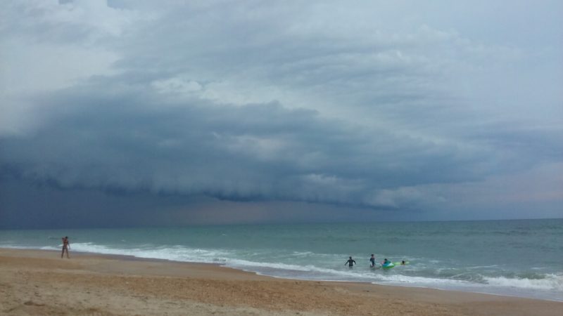
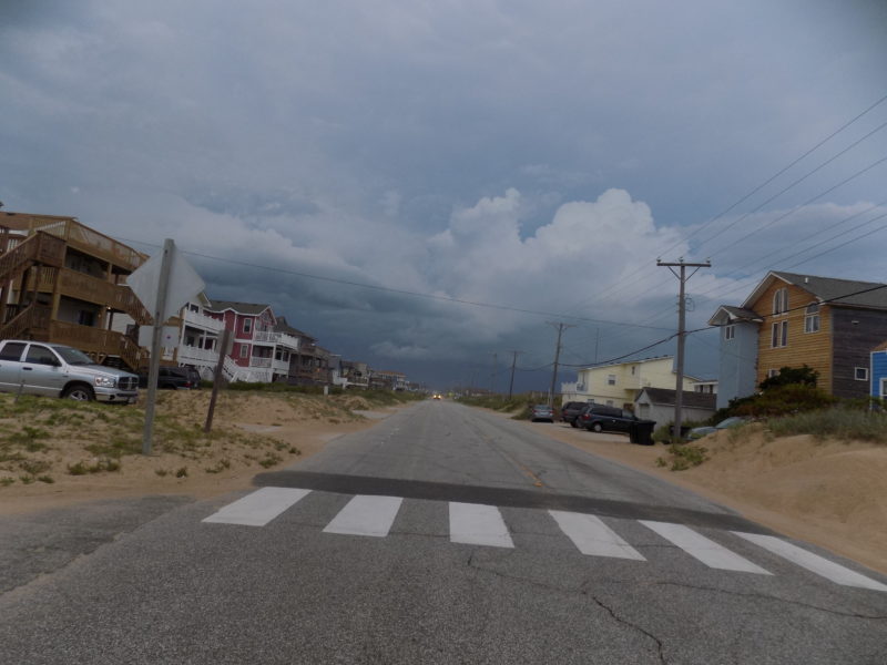
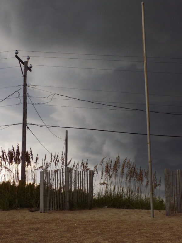
Above, a typical late afternoon front passing over. Usually dumping rain, spitting bursts of wind, rumbling, and flashing happens at the peak humidity of summer afternoons. Moisture from our inland waters evaporating and rushing offshore. Mother nature doing her job. The locals love this for many reasons: it cools our bustling work days down, it clears the tourists from the beaches, potential for a following surf, potential for a spike in fishing activity, and so on.
Hermine was a bitch. She stressed us out about the boat. The first week of September she came up the Gulf Coast of Florida and made landfall on the pan handle. Before crossing over land to the east coast, just to sweep her way up towards us. Luckily the boat was just fine. We did not fair so well on the Outer Banks.
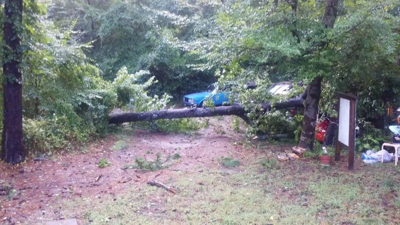
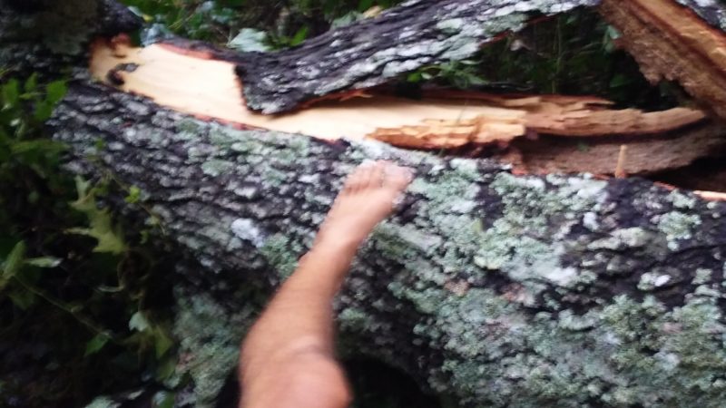
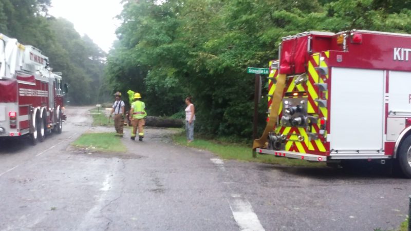
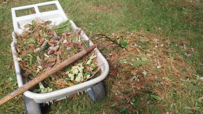
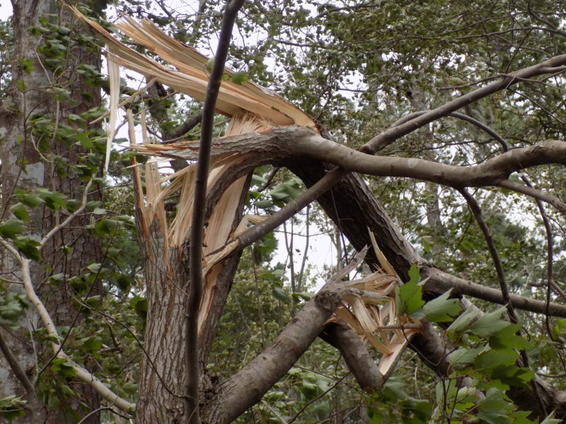
Trees down everywhere. Roads were closed and chainsaws were what you heard. The gumball trees were the worst, with rotten cores, they were fatties.
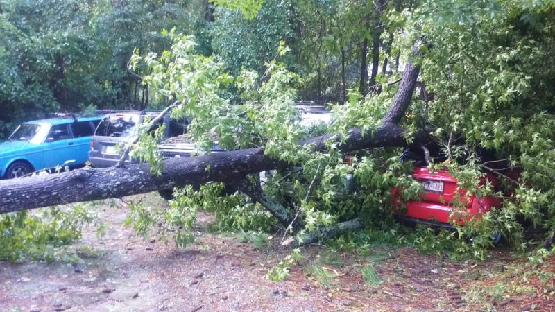
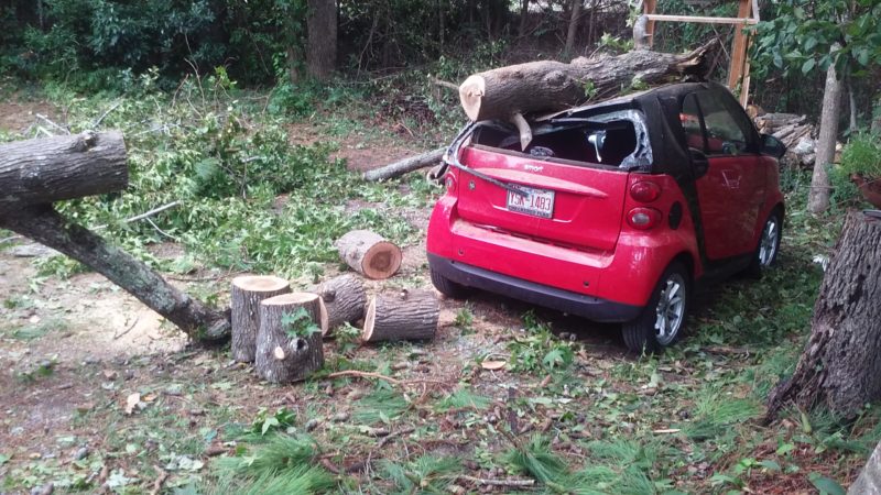
Damage shown here at my parent’s house in Kitty Hawk. My Mother’s smartcar did not make it.
Just having washed and vacuumed before parking it for the night. We woke up to this horror. The car itself was actually fine under the tree. Being a steel roll cage with a high safety rating, only the ceiling and rear window were shattered. She took the loss as totaled and we moved on to cleaning up.
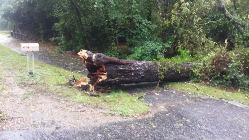
Another one of our trees, the historic one by our mailbox. The first big over-hang as you pulled down The Woods Road. I remember when this road was unpaved gravel and dirt, riding in the back seat looking up at the tunnel of massive trees.
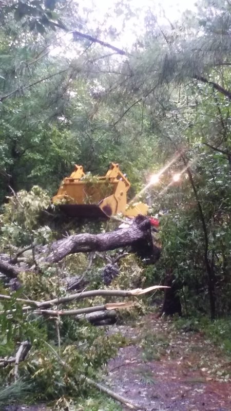
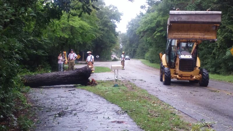
Thanks to the Kitty Hawk Fire Department for an extremely swift and helpful clean up. Cutting and dragging the larger trees out of our way.
Fun to watch these prototype wind mills handle the tail winds of Matthew.
Living next to the Dominion power station we had a front row seat to all the repairs. Workers coming in droves to send out trucks and quickly clean up our community.
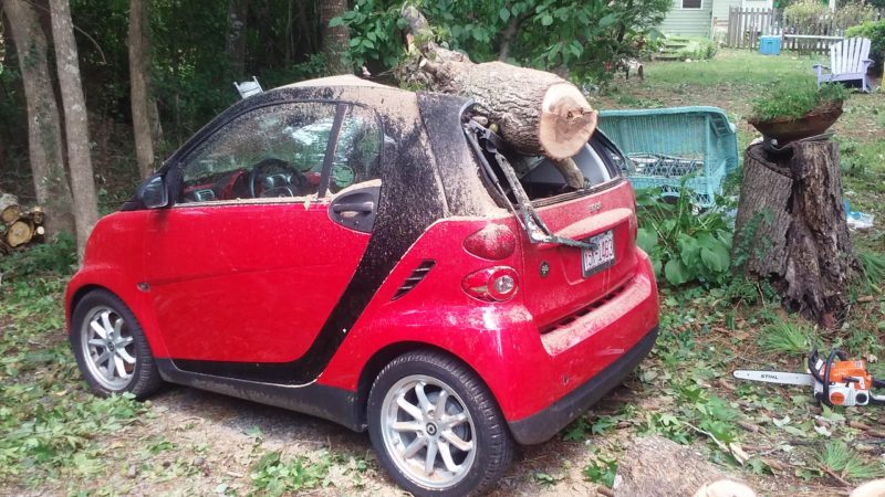
I begged to keep it and turn into a chop-top. Almost giving in to my requests; receiving the insurance check was the final result of this misfortune.
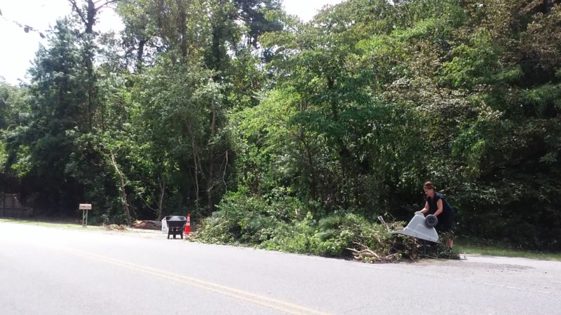
With the storm behind us, our little island focused on getting everything back in order for the return of tourists.
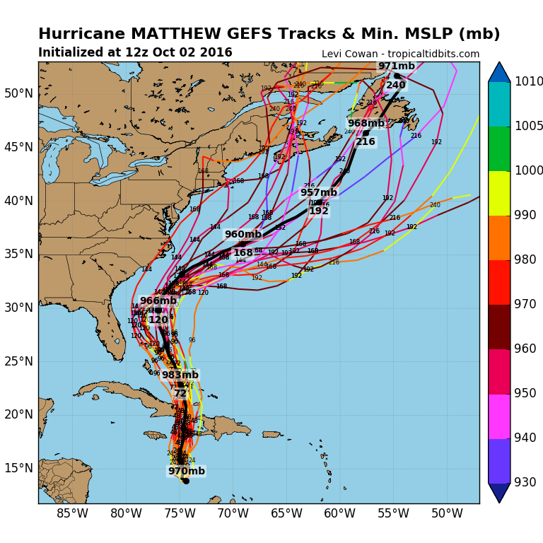
As you can see from the predictions above. Only about one of them was accurate.
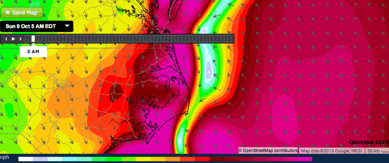
Below are Live screen shots I captured during the events of Hurricane Matthew. It was the middle of the night October 8 & 9 as the storm ground it’s way up the east coast and into the Pamlico Sound. Coming up behind us now. This body of water is the largest lagoon of barrier water on the eastern coast. Warm, brackish, and shallow – perfect to fuel Matthew’s last big punch. As you can see, the white is the eye with literally no wind. The rings and outward intensified.
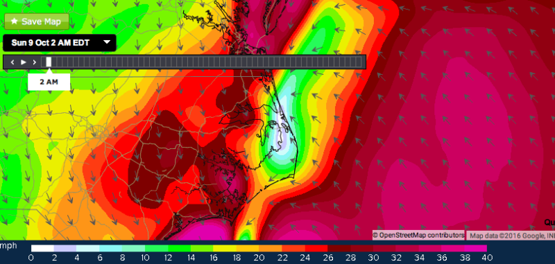
Our Sounds, rivers, and estuaries had enough warm moisture to elasticise the storm into a narrow band. Now having technically two plus eyes for a short period of time.
During the middle of the night I sat outside in the howling wind and spitting rain. Looking at the driveway I thought to myself “why is the ground so shiny?”.
With our island fast asleep, weather reports stated the storm would veer offshore south of Cape Hatteras and Diamond Shoals. (the outer most point of barrier island) You can see from my live screenshots that was not the case. It smeared right over us. Coming over the inland waters, pouring down on us filling our water table and then some!
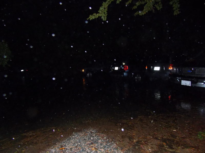
I took this photo to try and capture heavy rain, later noticing it was the point of total saturation. The water halfway up our tires.
Jumping in the volvo, the water was to the floorboards. Luckily she started up, driving her front end up a little hill and to higher ground. I then ran inside the house, waking people up to move vehicles. The flooding was well above the tires.
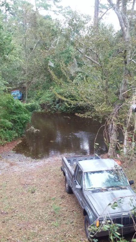
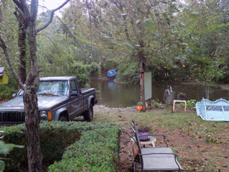
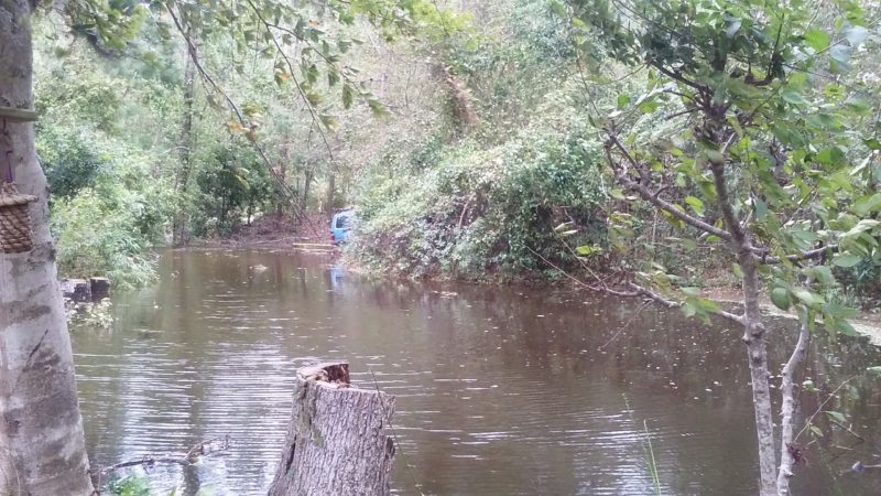
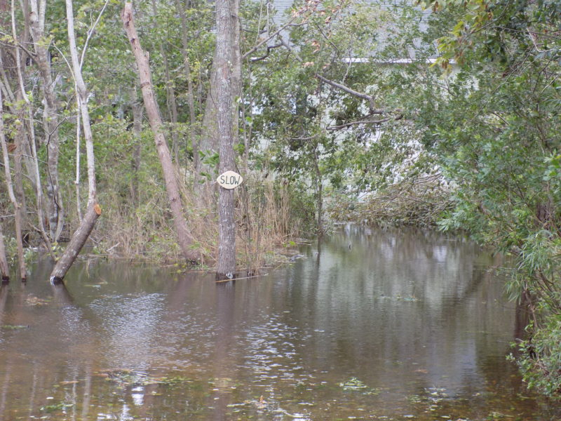
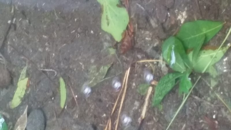
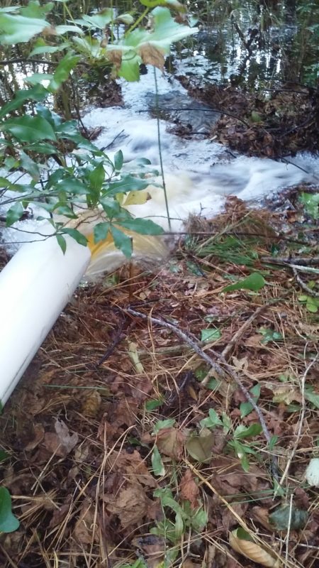
About waist deep in the middle of what was driveway. Who knows how deep our actual swamp holes were! Flooding like this is intense, though we have experienced it at least a few times in my life here. Tiny bubbles start coming up through the ground everywhere as the water tries to soak in. To speed up the process my father runs a gas powered water pump, moving the flood waters out of our swamp and into deeper areas.
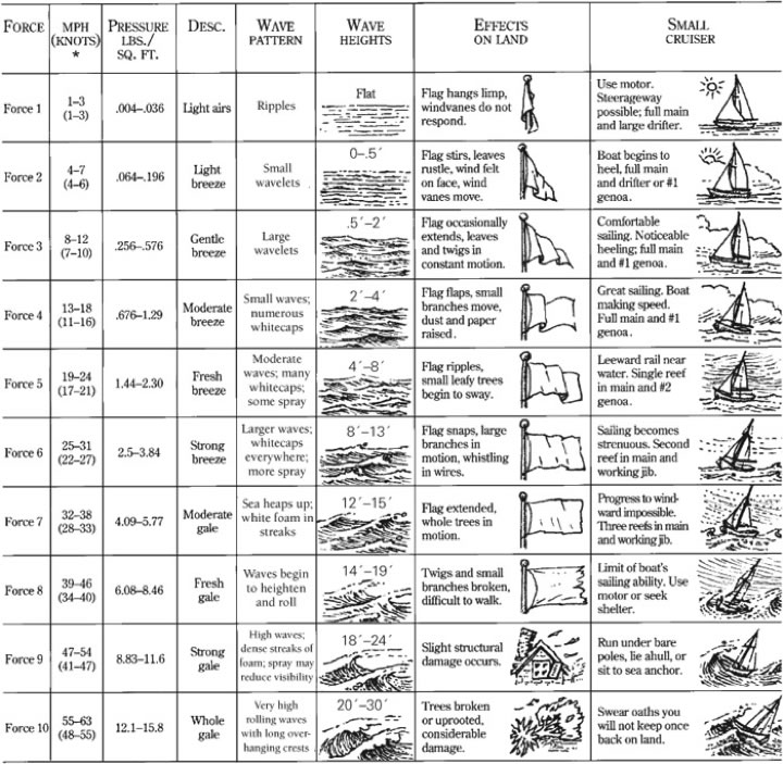
The Beaufort Wind Force Scale
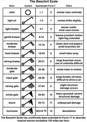
The tell-tale symbols are easy to remember as half sticks are 5 (knots) and the whole sticks are 10 (knots), the flag is 50 (knots). They determine wind direction on a weather chart, in the direction as if they were a flying arrow.
These links are useful for Hurricane Season:
http://spaghettimodels.com/ and http://www.nhc.noaa.gov/
I don’t know what this scale below is but I thought the Small Cruiser category was humorous.
Great photo library and dialog about our crazy fall 2016.